This Greenpeace report misses the mark in our opinion. Perhaps Greenpeace misunderstood the methods and tools that the Roundtable on Sustainable Palm Oil (RSPO) uses for hotspot monitoring and fire detection.
The report is based on the assumption that the RSPO hotspot monitoring is based off our public facing GeoRSPO. GeoRSPO is a transparency tool that is built on Global Forest Watch Map Builder. However, for internal monitoring, RSPO’s Investigation and Monitoring Unit (IMU), and specifically, our Geographic Information System (GIS) manager, use hotspot monitoring tools such as Global Forest Watch Pro, ESRI ArcGIS GIS Software Suite, and NASA Fire Information for Resource Management System (FIRMS) hotspots data, amongst others.
As we disclosed in September, fires were detected in some member plantations (278 fires in member concessions at the height of the fire season (10 – 16 September 2019) from a total of 73,508 hotspots for the week, which means hotspots in RSPO member concessions represented just 0.4%. The IMU actively followed up with each member where a hotspot was detected, to verify whether there was an occurrence of fire (and if so, what efforts are being made to extinguish the fire). Of the members who were investigated, they provided documentation such as police reports to explain the hotspots and occurrence of fire. Certifications Bodies will also be conducting additional independent on-ground investigations at the direction of the RSPO Secretariat.
Further, we have all concession maps from our members globally (of both certified and uncertified land banks), not just the ones published on the GeoRSPO webpage. This includes Malaysian maps in Sarawak and Peninsular Malaysia that are not on GeoRSPO1. These are also monitored internally. Please see our previous statement on Hotspot Data.
For further information, please contact:
|
Name: Dan Strechay Head of Communications T: + 1 973 809 8912 |
Name: Sara Cowling Communications & Content Manager T: +603 2302 1500 |
Keep reading

RSPO Board of Governors Endorses Proposal to Form Executive Committee for Operational Oversight

Book Your Slot for the Additional prisma Clinic Session at RT2025
Advancing Jurisdictional Certification in Sabah: Strengthening Collaboration Between RSPO, UNDP, and Jurisdictional Approach System for Palm Oil (JASPO)
Call for Expression of Interest: Independent Investigation of a Complaint

Leading Labels: RSPO Among Top Sustainability Labels in Dutch Market
The 21st International Oil Palm Conference Successfully Took Place in Cartagena, Colombia
Top Performers of the 2025 Shared Responsibility Scorecard
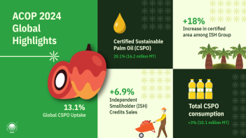
ACOP 2024: RSPO Market Trends Resilient Despite Global Challenges


