The Roundtable on Sustainable Palm Oil (RSPO) takes the issue of fire – whether intentionally set for land clearing or accidental – very seriously and prohibits its use under our standard.
The RSPO has been actively monitoring, with satellite technology, all detected fire hotspots within both RSPO certified and non-certified concessions in Malaysia and Indonesia. Since January 2018, we have made this satellite information, along with the location of member concession areas, publicly available on our website.
With seasonal patterns1 in Indonesia and Malaysia causing an increase in hotspots and forest fires, resulting in haze and other negative environmental impacts that much of the region are currently experiencing, RSPO’s Geographic Information System (GIS) Manager and Investigation and Monitoring Unit (IMU) are following the situation closely.
As of 10 September, 2019, we detected a total of 244 hotspots within RSPO member concessions from a total of 48,4222 hotspots across Malaysia and Indonesia. This means that hotspots in RSPO concessions represent approximately 0.50% of all hotspots detected. However, this is still too many in our opinion. The IMU are actively following up with each member where a hotspot has been detected, to verify whether there is an occurrence of fire (and if so, what efforts are being made to extinguish the fire) or not.
In our commitment to transparency and accountability, our interactive map application GeoRSPO is publicly available and displays relevant data relating to members’ concessions and land cover, including any active hotspots. We remain committed to our strengthened Principles and Criteria (P&C) relating to fire prevention and a complete ban of the use of fire within RSPO certified units. We applaud our members for committing to these most stringent standards and encourage them to continue to monitor their concessions.
1https://public.wmo.int/en/our-mandate/climate/el-ni%C3%B1ola-ni%C3%B1a-update
2https://earthdata.nasa.gov/earth-observation-data/near-real-time/firms
Keep reading
Advancing Jurisdictional Certification in Sabah: Strengthening Collaboration Between RSPO, UNDP, and Jurisdictional Approach System for Palm Oil (JASPO)
Call for Expression of Interest: Independent Investigation of a Complaint

Leading Labels: RSPO Among Top Sustainability Labels in Dutch Market
The 21st International Oil Palm Conference Successfully Took Place in Cartagena, Colombia
Top Performers of the 2025 Shared Responsibility Scorecard
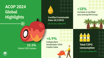
ACOP 2024: RSPO Market Trends Resilient Despite Global Challenges

RSPO: Actions for the Certification of Sustainable Palm Oil Production


